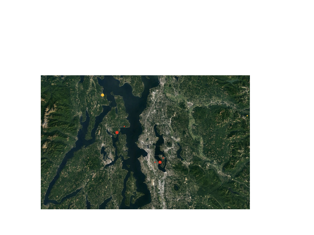
An informal regional Puget Sound map, with dots showing verified and candidates die-off sites, size and color a very rough indicator of status and severity.
Small, unverified sites may not stand up to scrutiny.
- Seward Park (first reported 2014, 15 acres, verified, spreading)
- Suquamish (2010, 2 acres, verified, spreading)
- Indianola (2017, < 0.1 acres, not yet visited)
- Cheasty Mountain View (2017, 0.5 acres, verified, spread status unknown)
- Mercer Island Upper Luther Burbank Park (2016, < 0.1 acres, verified, spread status unknown)
- Port Ludlow ( 2017, < 0.1 acres, not yet visited)
- Baring (2017, < 0.1 acres, not yet visited)
I read that Post and got it fine and informative. Please share more like that...
ReplyDeleteΣίτες
Thank you for this collection of information. Now I can recognize that there is definitely signs of mid-stage, and complete sword fern die-off in some of the 2nd and 3rd growth forests on the Kitsap Peninsula where I live. I noticed the dead and dying ferns located in forests that were initially logged in the late 1800’s, then again in the 1920’s, and again in the 1980’s. Since the 1980’s the forest has become gradually populated by English Ivy, Even though Ivy has been removed from many of the trees in the past decade, the ivy has developed a foothold on the forest for almost 40 years now. My question I would wish to ask a soil and plant biologist is: Might the 3rd growth forest, combined with the 3 to 4 decade invasion of English Ivy, be contributing to a soil condition or chemistry which is inhospitable to Sword Ferns?
ReplyDeleteI thought I would pass this question on to you, and to the universe of citizens scientists! Thank you for your good work on this sad problem.
MW